February 7, 2012
| Today’s hike was on the Chattooga River Trail in SC from Burrell’s Ford Campground Parking lot to Ellicott Rock (the survey mark for NC/SC/GA). See history below.
HIKERS – John Bellamy, Phil Brownrigg, Dan Euliss, Pam Euliss, Dave Hinson, Bill Hunt, Jack Jacobi, Dick Metzgar, Jeanne O’Connor, Vic Robson, Dan Ross, Pom Sinnock ELLICOTT ROCK HISTORY – (From Wikipedia, the free encyclopedia) In 1811, Andrew Ellicott made a survey for the State of Georgia to resolve the boundary dispute between Georgia and North Carolina. He marked a large rock in the Chattooga River with “NC-GA”, standing for North Carolina – Georgia. Two years later commissioners representing South Carolina and North Carolina marked a large rock along the Chattooga River bank with the inscription “Lat 35 AD 1813 NC + S.C.” as the juncture where the South Carolina and North Carolina state lines joined. The rock marked by the S.C. and N.C. commissioners in 1813, rather than the rock marked by Ellicott in 1811, is usually called Ellicott’s Rock. It is also known as Ellicott Rock. This is commonly accepted as the point where the boundary lines of South Carolina, North Carolina, and Georgia join. There are two versions in print on the distance between the two rocks. One is that Ellicott’s original rock was 500 ft upstream.[2] In the other story, the rocks are much closer. De Hart’s South Carolina Trails guide said that they are a “few feet apart.”[3] In the North Carolina trail guide, he said Commissioner Rock is “ten feet downstream” This rock was listed in the National Register of Historic Places in 1973 and is located in Ellicott Rock Wilderness. The South Carolina Department of Archives and History has additional information, and copies of the nomination forms. TRAIL INFORMATION – Parking at Burrell’s Ford Campground parking lot, we hiked up the Chattooga River to Ellicott Rock and back. We also did the side trail up to Spoonauger Falls. It is a mostly flat hike with only a few short inclines. Most of the hike keeps you in view of the federally designated “Wild and Scenic Chattooga River” The forest is mixed with majestic White Pines and Eastern Hemlocks along with various hardwoods, rhododendrons and mountain laurel. We rate the hike easy except for several large trees down across the trail and one difficult stream crossing (depending on the water level). Directions: From Walhalla, take SC 28 north to SC 107. Turn right onto SC 107 and follow for 10 miles to Forest Service road 708 (Burrells Ford Road on left). Travel about 2 miles or so down this gravel road and park in the campground parking lot . Another great day for a hike! Fair and cold with temperatures ranging from 19 to 38 degrees F. Hiking distance – approx. 7.6 miles. FLOWERS IN BLOOM: none BIRDS IDENTIFIED:Carolina Chickadee, American Crow, Pileated Woodpecker, Robin, Belted Kingfisher and 14 Turkeys. OTHER FAUNA: Rainbow Trout |
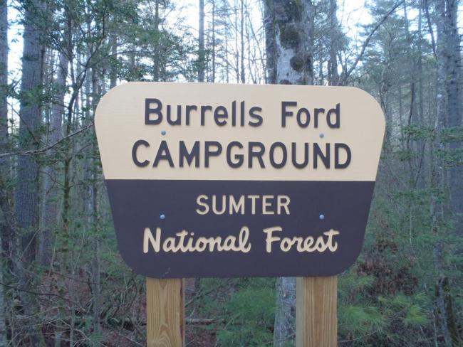 The starting point for today’s hike. |
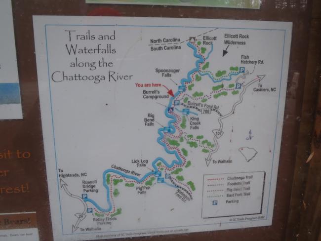 Nice trail information map. |
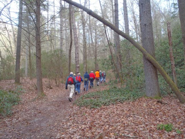 Another great day for a hike along the Chattooga River! |
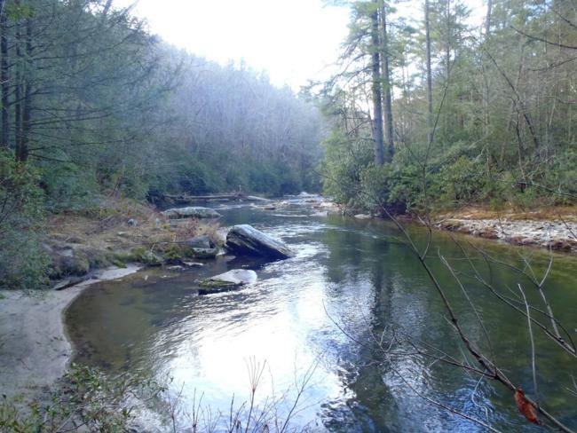
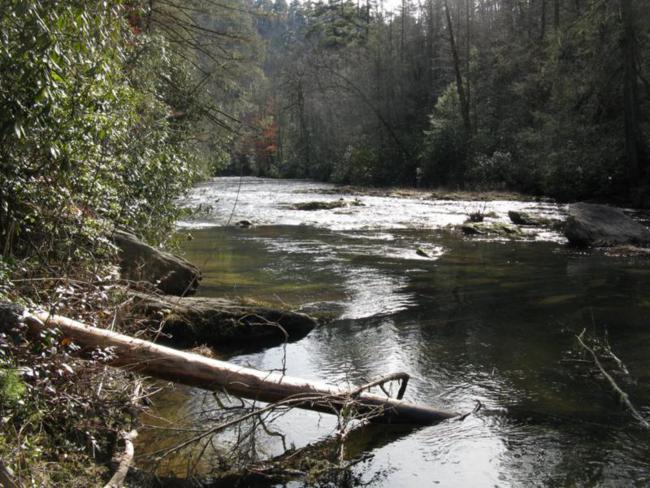
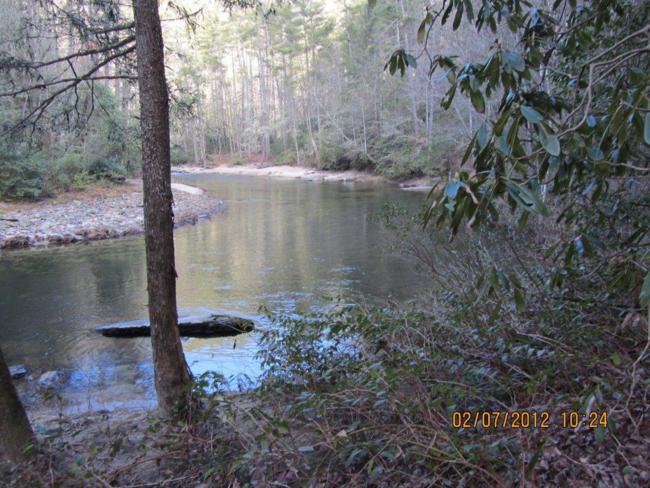 A peaceful section of the upper Chattooga River. |
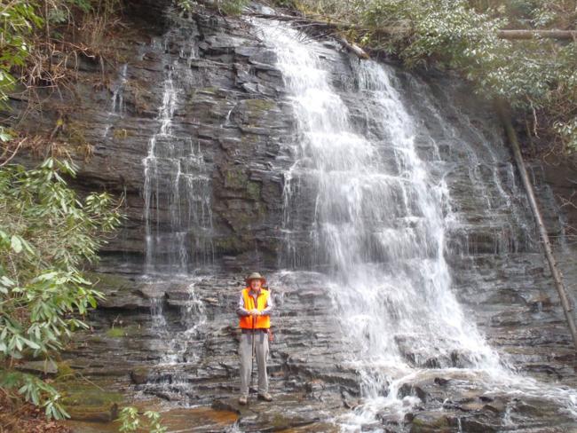 A short side-trail leads up to beautiful Spoonauger Falls. |
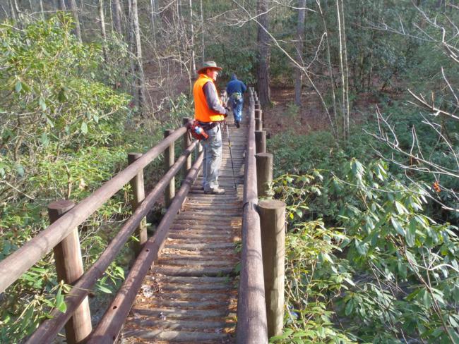 Crossing the foot-bridge across the East Fork of the Chattooga.. |
 Great river views all along the trail! |
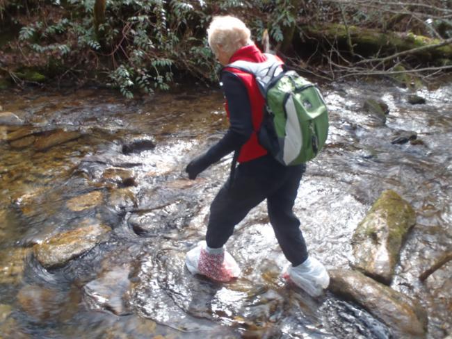 Crossing Bad Creek is very slippery and plastic bags come in handy. |
 Getting closer to the NC line. |
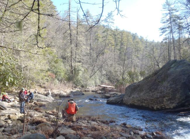
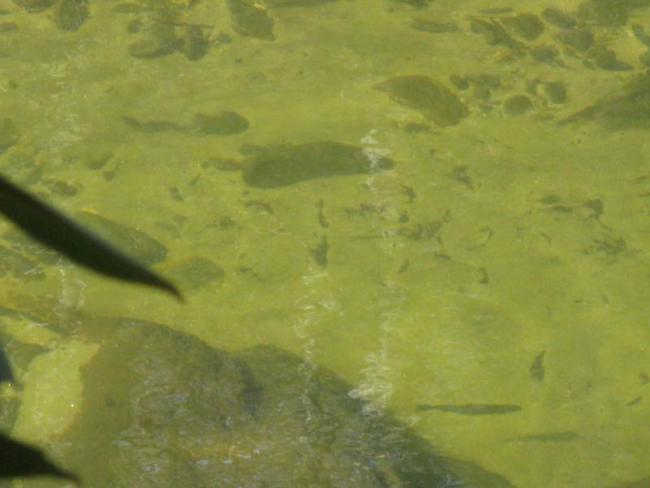 We spotted several trout in the clear water. |
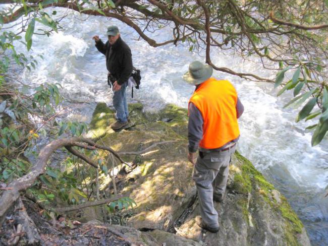 Finding the engraved rock at the state line requires scrambling down some slippery rocks to the edge of the river. |
 The original Ellicott Rock (1811) simply has NC engraved. Looks like someone has recently scraped the algae out of the letters. |
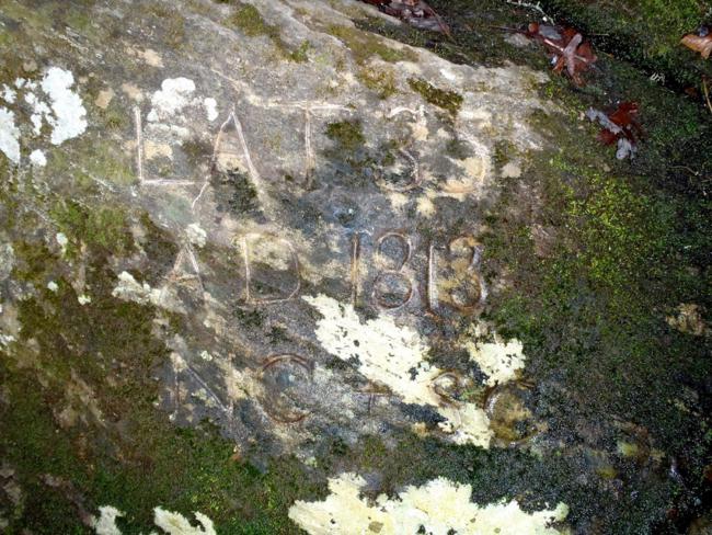 This is the rock engraved by the commissioners in 1813. Most folks never find these to rocks due to the treacherous slope on the edge of the rapids. |
 Our nice lunch spot a quarter mile south of Ellicott Rock. |
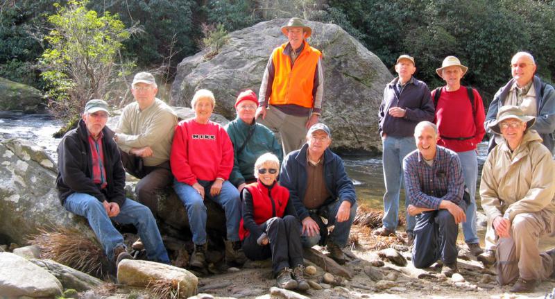 The OFHC gang for today’s hike! (l-r) Vic Robson, Bill Hunt, Jeanne O’Connor, Dave Hinson, Pam Euliss, Pom Sinnock, Dan Euliss, Phil Brownrigg, Dan Ross, John Bellamy, Dick Metzgar and Jack Jacobi. |