August 5, 2014
|
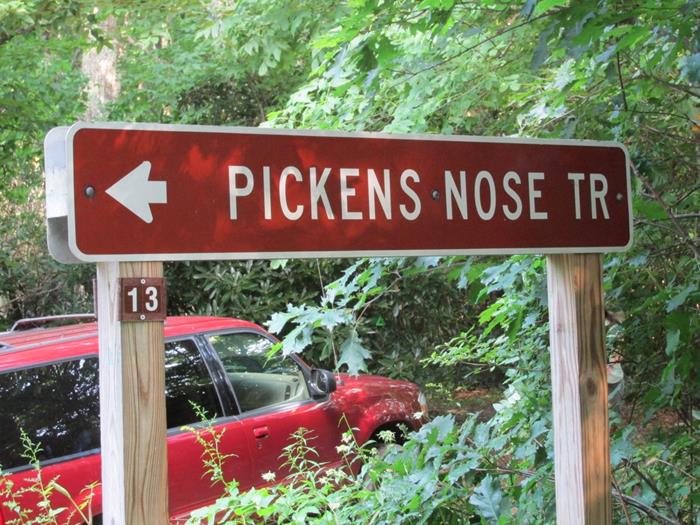
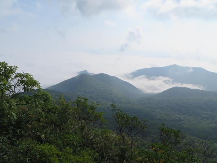
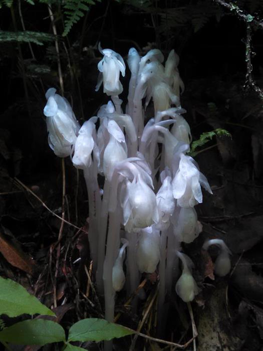
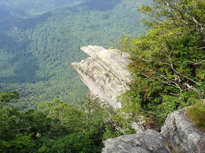
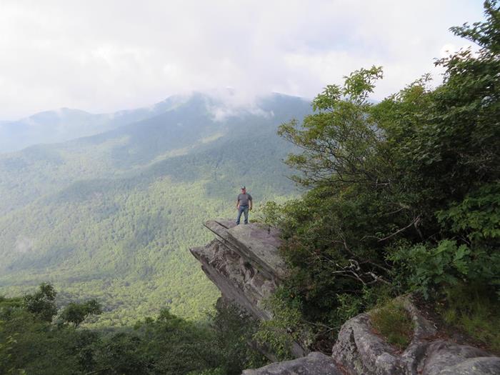
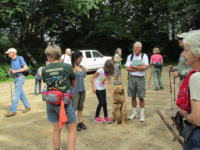
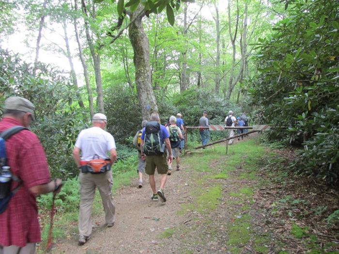
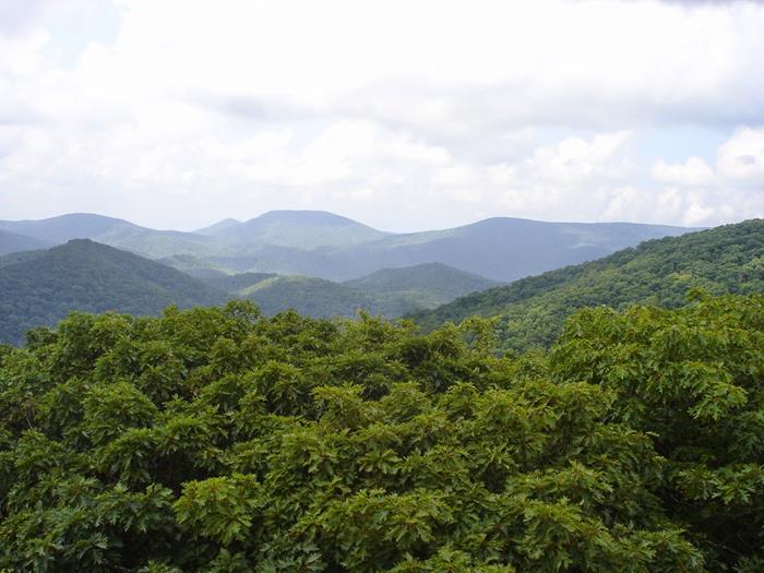
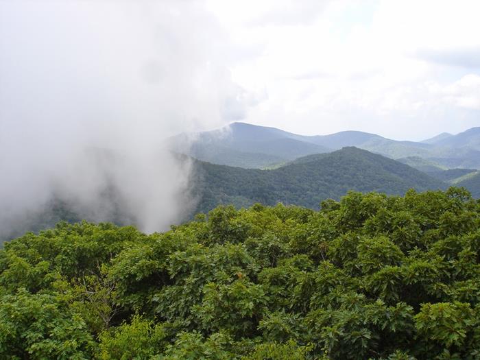
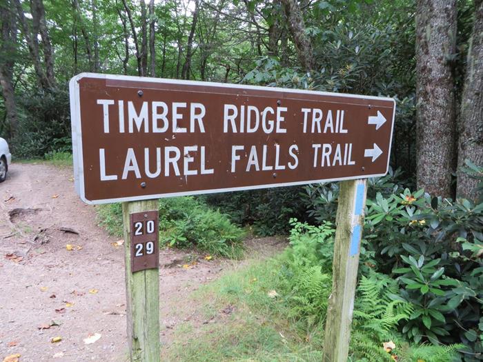
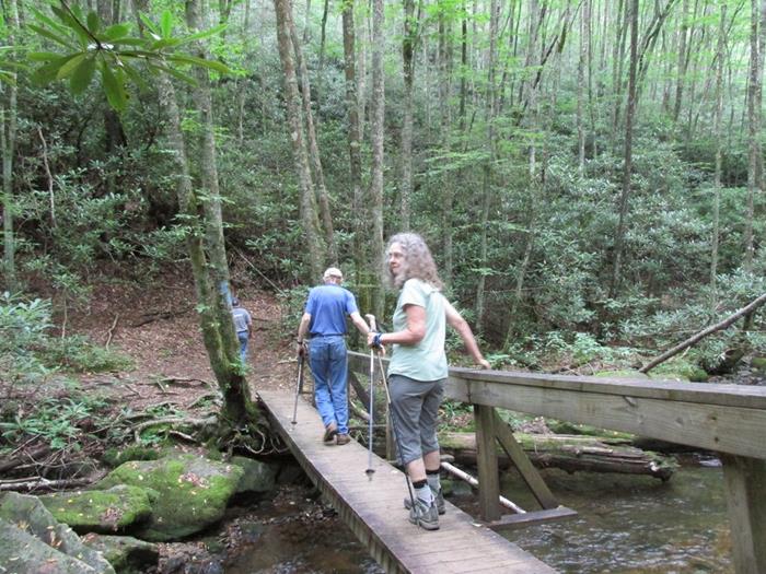
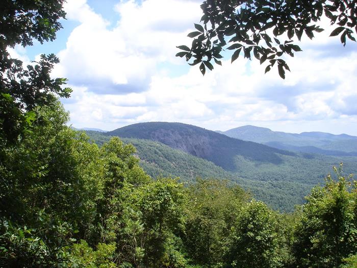
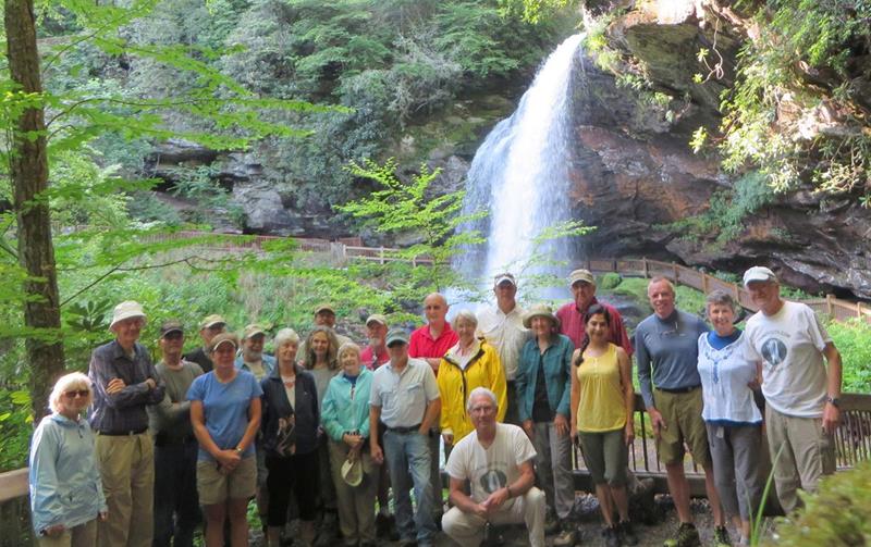
This week’s hike was on three trails. First was the Pickens Nose Trail followed by the Appalachian Trail to Albert Mountain followed by the Laurel Falls Trail near the Standing Indian Campground. HIKERS: Phil Brownrigg, Jan Burgess, Cup Gales, Stephen Gales, Tim Hale, Charles Hall, Adam Hunt, Bill Hunt, Layne Hunt, Kim Johnson, Mike Jones, Dick Metzgar, Trushna Nadig, Huck Phillips, Tony Presley, Joe Raguckas, Sandy Robson, Vic Robson, Bob Magee and Carole Wintle. TRAIL INFO. – Pickens Nose Mountain was named after Revolutionary War General Andrew Pickens. The Pickens Nose Trail is heavily used by rock climbers/rappelers since it has magnificent rock faces. The views there are awesome! Our second hike started at the parking lot below the summit of Albert Mountain, there is a connector trail up to the Appalachian Trail and then we follow the A.T. up to the summit and fire tower for some of the most spectacular views on the entire 2,000+ mile Trail. The Laurel Creek Trail is on the forest service road toward Standing Indian Campground. Laurel Creek Falls is a beautiful jewel in the NC mountains and the creek combines with others to form the headwaters of the Nantahala River. Total hiking distance today – About 5 miles with considerable elevation gain. We rate the hike moderately easy. Directions: Take highway 441 north from Clayton, GA to the community of Otto, NC. Turn left onto Coweeta Lab Road . Drive several miles up this road and you will see the Coweeta Hydrologic Lab on your right. Continue on past the lab and the road becomes a gravel Forest Service road 83. Continue up this road for several miles and you will come to a sign for Pickens Nose. There is a parking area here. For Albert Mountain, continue on past this area a mile or so and there is a fork in the road and a sign pointing to the right to Albert Mountain. Continue on the right fork to the end of the road where there is a parking area. Hike up the connector trail behind the gate to the A.T. and turn right to Albert Mt. For Laurel Creek Falls, drive back down the road from Albert Mountain and turn right onto F.S. road 83 and continue several miles to the trail sign on the left. Another great day for a hike! Partly Cloudy with temperatures steady in the mid-60’s F. FLOWERS IN BLOOM: Heal-all, Purple-flowering Raspberry, Turk’s Cap Lily, Southern Harebell, Spotted Jewelweed, Lance-leaved Loosestrife, Oxeye Daisy, Tall Bluet, Bush Honeysuckle, Thin Leaved Sunflower, White Yarrow, Downy Phlox, Angelica, Rosebay Rhododendron, Indian Pipes, Lance-leafe Coreopsis, White Snakeroot, Heal-All, White Bee Balm, Joe Pye Weed, Black-eyed Susan . Birds Identified: Blue Jay, Broad-winged Hawk, Pine Warbler, Towhee, Junco, Nuthatch .
|