July 25, 2017
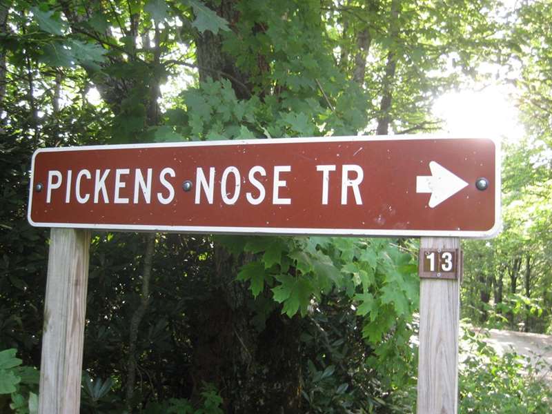
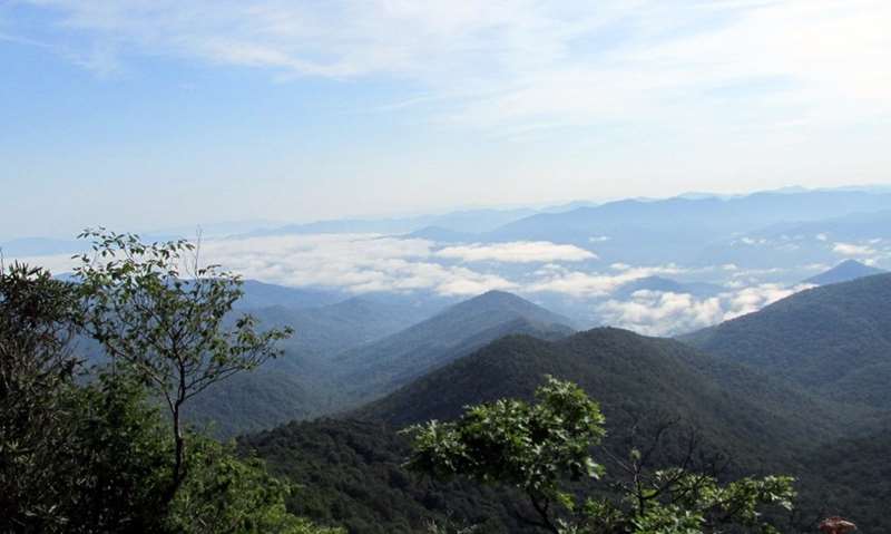
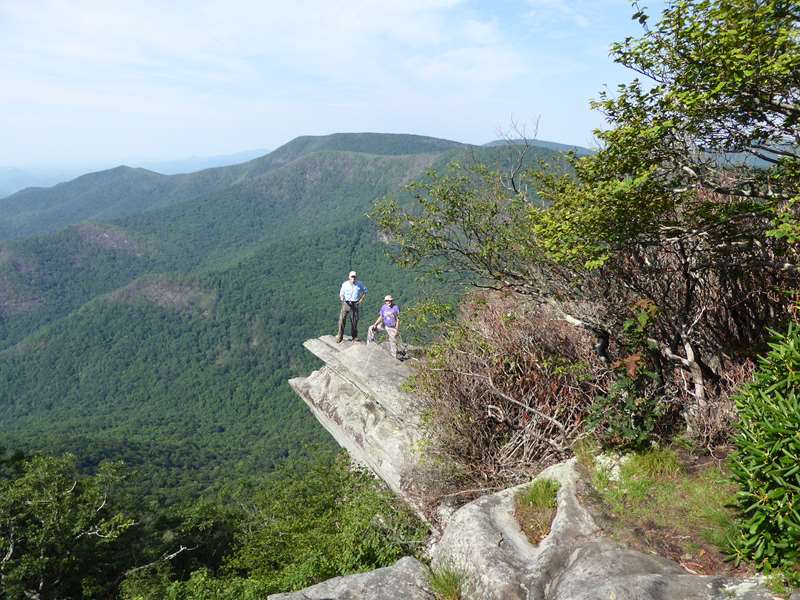
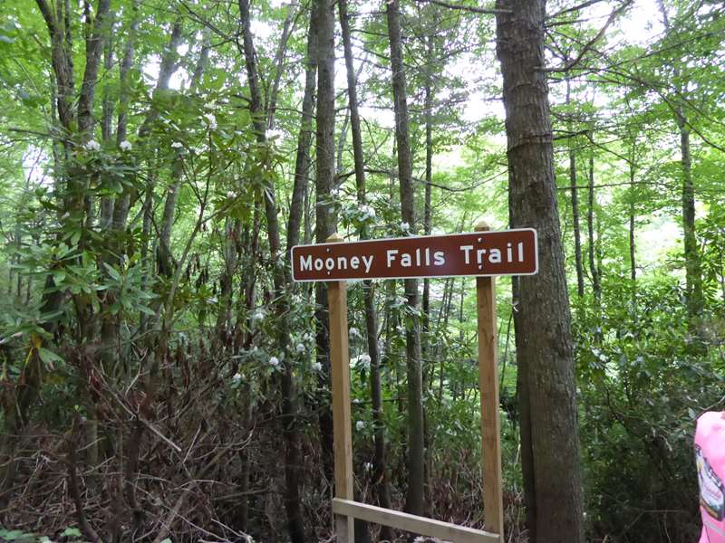
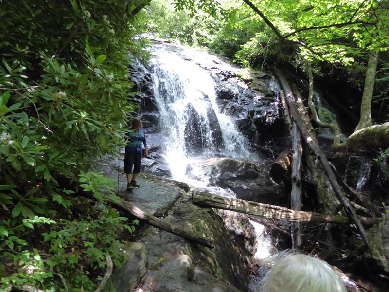
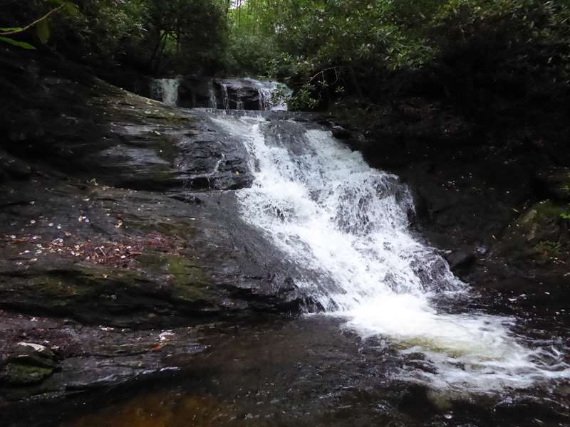
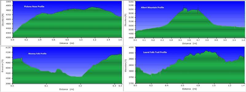
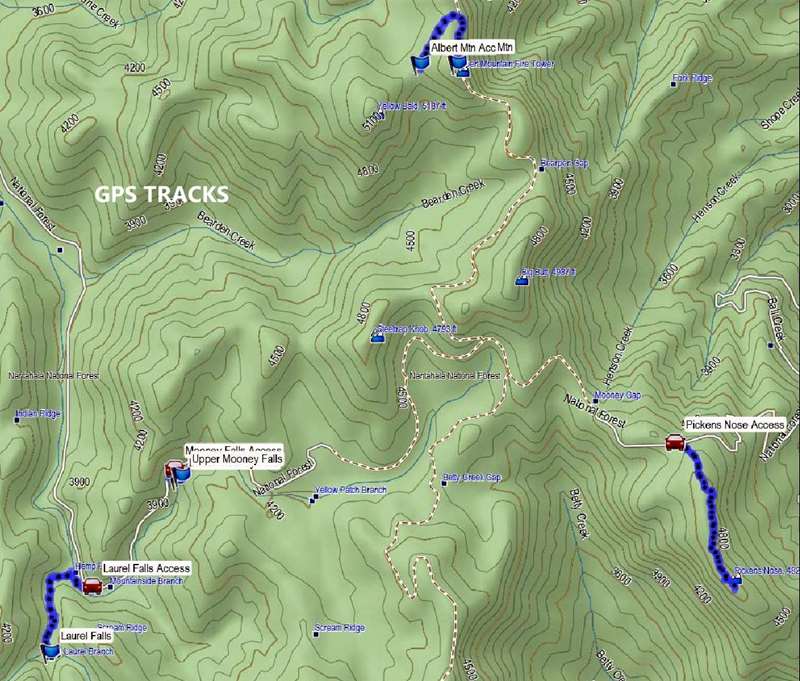
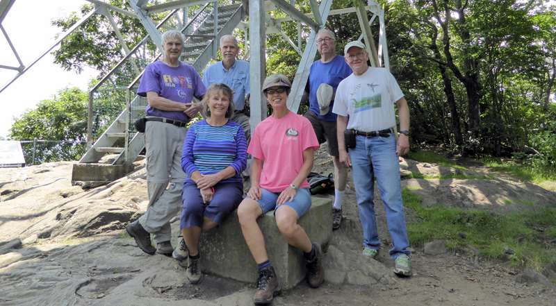
| Today’s hike was in the Standing Indian area near Franklin, NC. We hiked 4 short trails including Pickens Nose, Albert Mountain, Mooney Falls and Laurel Falls.
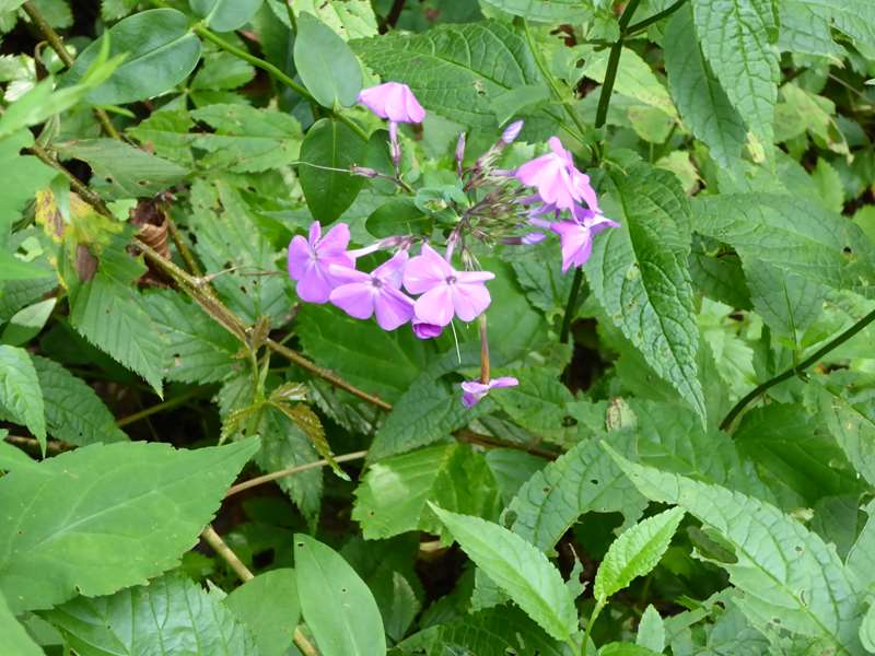
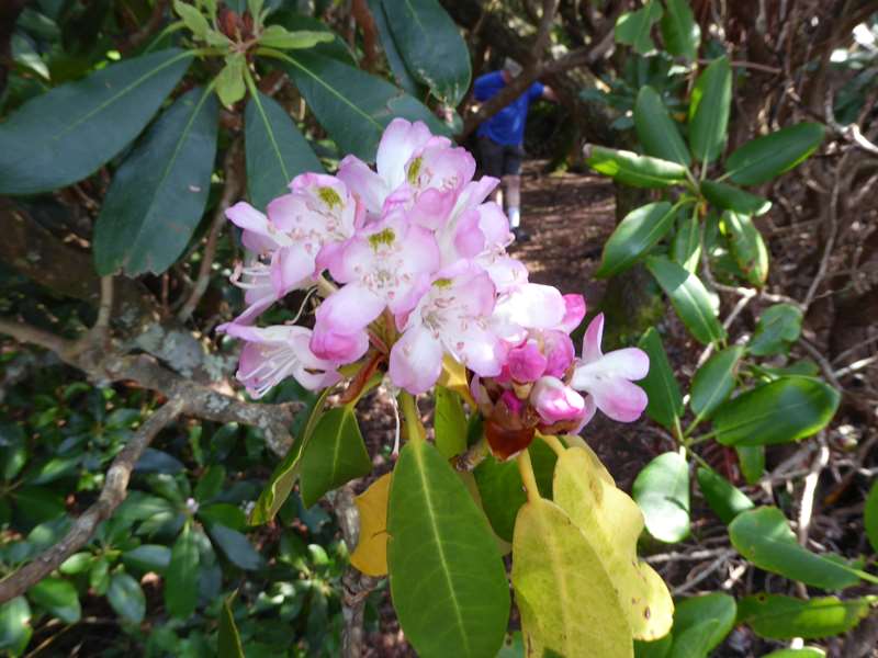
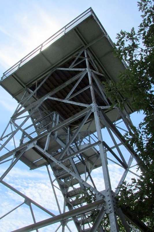
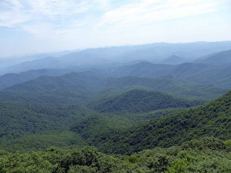
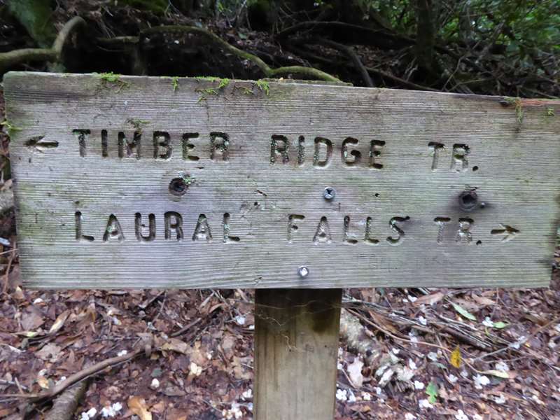
HIKERS – Mike Bell, Renee Corbett, Tim Hale, Dick Metzgar, Tony Presley and Malivia Swanson. TRAIL INFO. – Pickens Nose Mountain was named after Revolutionary War General Andrew Pickens. It is said that he had a rather pronounced nose and the pronounced rock formation at the summit led to the name. The Pickens Nose Trail is heavily used by rock climbers/rappelers since it has magnificent rock faces. The views there are awesome! Our second hike started at the parking lot below the summit of Albert Mountain, there is a connector trail up to the Appalachian Trail and then we follow the A.T. up to the summit and fire tower for some of the most spectacular views on the entire 2,000+ mile Trail. The Mooney Falls Trail and Laurel Creek Trail are on the forest service road toward Standing Indian Campground. Mooney Falls Trail is only a quarter mile or so long to a very nice waterfall. Laurel Creek Falls is a beautiful jewel in the NC mountains and the creek combines with others to form the headwaters of the Nantahala River. Total hiking distance today – 4.5 miles with considerable elevation gain. We rate the hike difficulty only moderate since the hikes were short. Directions: Take highway 441 north from Clayton, GA to the community of Otto, NC. Turn left onto Coweeta Lab Road . Drive several miles up this road and you will see the Coweeta Hydrologic Lab on your right. Continue on past the lab and the road becomes a gravel Forest Service road 83. Continue up this road for several miles and you will come to a sign for Pickens Nose. There is a parking area here. For Albert Mountain, continue on past this area a mile or so and there is a fork in the road and a sign pointing to the right to Albert Mountain. Continue on the right fork to the end of the road where there is a parking area. Hike up the connector trail behind the gate to the A.T. and turn right to Albert Mt. For Mooney Creek and Laurel Creek Falls, drive back down the road from Albert Mountain and turn right onto F.S. road 83 and continue several miles to the trail sign on the left. Another great day for a hike! Partly Cloudy with temperatures ranging from 68 to 74 degrees F. FLOWERS IN BLOOM: Mountain Mint, White Bee Balm, Coreopsis, Turk’s Cap Lily, Red Bee Balm, Heal-all, Purple-flowering Raspberry, Tall Bluet, Dodder, Bush Honeysuckle, Rosebay Rhododendron, Sundrops, Goat’s Beard, Black-eyed Susan. Birds Identified: Vireo, Blue Jay, Veery, Black and White Warbler, Pine Warbler, Towhee, Junco, Nuthatch .
|